UTM Measure is a powerful app designed for measuring areas and distances with precision. It offers the ability to register points, lines, and polygons using Satellite Imagery map data or GPS data. UTM Measure comes equipped with advanced spatial drawing and editing tools, allowing users to perform a range of spatial analyzes such as overlays and buffering. With the option to store an unlimited amount of data in a local database, including photos and notes, users can easily export their data to various file formats. UTM Measure also supports a wide range of Coordinate Reference Systems, making it a versatile tool for professionals and enthusiasts alike.
Features of UTM Measure:
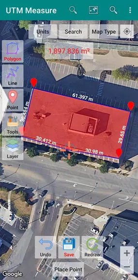
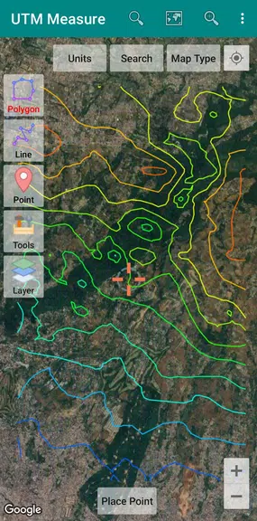
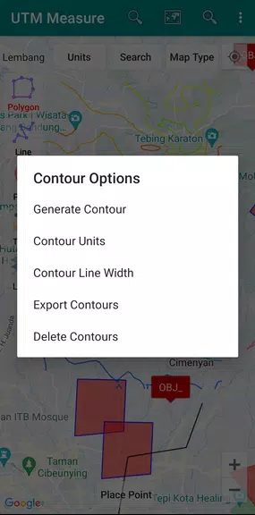
> **Sophisticated Spatial Drawing Tools**: The app is equipped with a range of advanced spatial drawing and editing tools, making it easy for users to create accurate and detailed maps.
> **Flexible Data Storage**: Users can store an unlimited amount of data in their local database, including information such as feature names, photos, labels, and notes. This allows for comprehensive record-keeping and organization.
> **Export Options**: The app offers the ability to export data to KML, DXF, or CSV files, allowing users to easily share their work with others or integrate it into other software.
> **Wide CRS Support**: The app supports Coordinate Reference Systems from around the world, making it versatile and adaptable to a variety of geographic locations and projects.
Playing Tips:
> **Utilize Advanced Drawing Tools**: Take advantage of the app's sophisticated spatial drawing tools to create precise and detailed maps. Experiment with features such as snap nearest, cutting polygons with lines, and combining lines.
> **Organize Data**: Make use of the unlimited data storage capability to keep track of important information related to your projects. This can help streamline your workflow and improve overall efficiency.
> **Explore Export Options**: Export your data to KML, DXF, or CSV files to easily share your work with others or collaborate on projects. This can enhance communication and collaboration among team members.
Conclusion:
Overall, UTM Measure is a powerful and versatile mapping app that offers a wide range of features to help users create detailed and accurate maps. With its sophisticated spatial drawing tools, flexible data storage options, and support for various Coordinate Reference Systems, it is a valuable tool for professionals and enthusiasts alike. By following the playing tips provided, users can make the most of the app's capabilities and unlock its full potential for their mapping projects. Download UTM Measure today and take your mapping skills to the next level!
Additional APP Information
Version
1.9.0
Size
10.1M
Language
English
Rating
4.4
Package Name
com.yogantara.measure
Developer
Y2 Tech